AGIS & ALP
Geographic Information Systems (GIS)
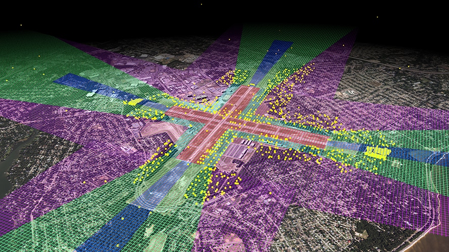
Geographic Information Systems (GIS) helps us determine our client’s current and future use of pertinent data. Attribute information is linked to its geographic location or a local reference system and stored in a database for easy retrieval through a full-functioning Spatial Information Systems (SIS) or Building Information Modeling (BIM) application.
Airport Asset Management
We provide highly-detailed 3-D spatial modeling services in a variety of formats, including Revit and SolidWorks. The models can also be animated to create 3-D fly-thrus and/or 4-D simulations. These services can provide solutions for:
- Architectural / Structural Design
- Utility Layouts
- Facility ManagementSpatial Planning
- Geographic Information Systems (GIS) / Building Information Modeling (BIM)
- Presentation Graphics & Visualization
Deliverables
Typical deliverables include:
- 2-D and/or 3-D Planimetric / Topographic CADD Drawings
- 3-D Digital Terrain Models (DTM) / Digital Elevation Models (DEM) / Triangulated Irregular Network Files (TIN)
- GIS Shapefiles
- Area and/or Volume Calculations
- Land Use / Environmental Change Analysis Reports
- Legal Exhibits
Obstructions Management
After mapping Landing Approach Surface Obstructions using Aerial Photogrammetry, the information is brought into ArcGIS for data management and attaching proper attributes. This information can be arranged to deliver the elevations of all obstructions above approach surfaces in an easy to manage format.
Martinez Geospatial
2915 Waters Road, Suite 108
Eagan, MN 55121
Phone: 651-686-8424
Fax: 651-686-8389
